
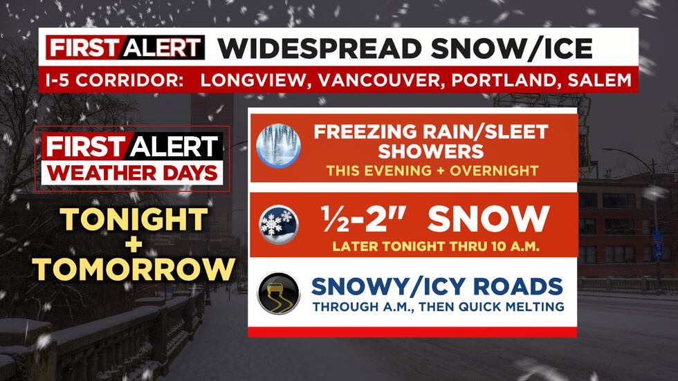
Freezing rain and snow returns this evening
Portland picked up its first (and maybe only?) official snowfall of the winter with 1.4” falling so far.
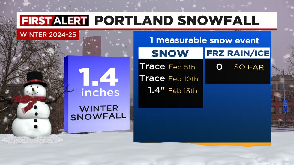
Generally most of us in the I-5 corridor from Longview to Albany picked up 1-3” out of the first band of precipitation that moved through. Much of the coastline saw brief freezing rain, but 2” fell up around Astoria.
We’ve had a brief break this afternoon, but now increasing “mixed showers” of freezing rain, ice pellets, and snow arrive during the evening. This is because a warmer layer of air moves in overhead. Snowflakes falling down melt, then fall into the sub-freezing airmass over us. They either re-freeze as little chunks of ice (ice pellets), or fall as liquid rain and form an icy glaze on contact (freezing rain).
TONIGHT
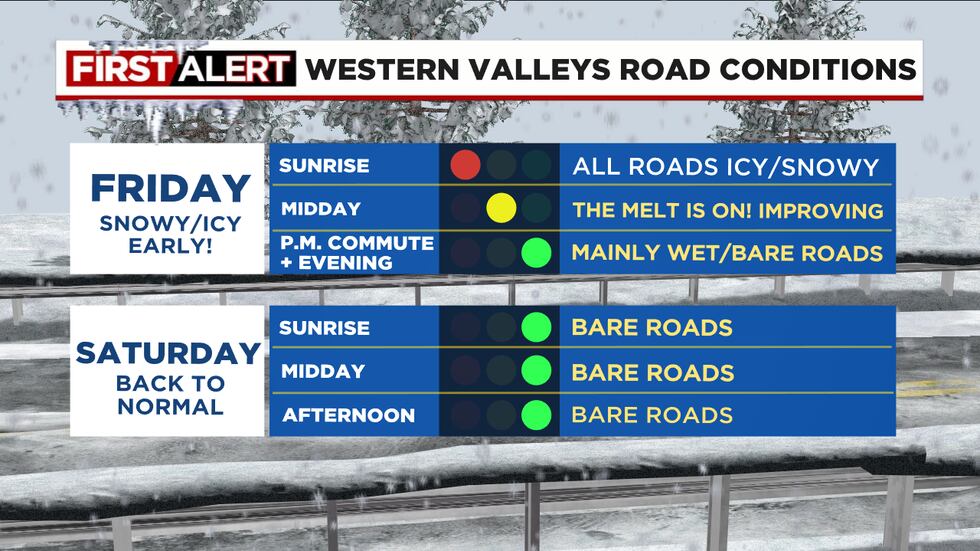
Those showers continue off/on all night, not a lot, but enough to re-freeze any roads that melted during the day. Gusty east wind continues tonight as well. All untreated roads west of Cascades (except coastline) should be turning very icy and will be frozen for the Friday morning commute.
TOMORROW MORNING
Precipitation changes back to snow before sunrise as air turns colder overhead once again. Temperatures hover around freezing or just below through the morning commute (or what’s left of it). I expect ½-2″ additional snow ending at 10am Friday. This means things will pretty much be shut down the first part of tomorrow. The good news? Cold east wind is gone by sunrise! This event will be over before noon.
THE REST OF VALENTINE’S DAY
Temperatures rise well above freezing the rest of Friday; don’t cancel those dinner plans Friday evening! Many roads will be just fine by mid-late afternoon. The melt is on… We top out in the lower 40s tomorrow with just a rain shower or two after noon. Roads will not re-freeze Friday evening.
SATURDAY
Lots of clouds, but just a shower or two. Temperatures in the 40s
Copyright 2025 KPTV-KPDX. All rights reserved.

Read More: Freezing rain and snow returns this evening